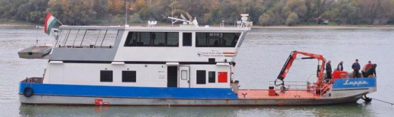
Below you’ll find a selection of deliverables from the AVIS project, offering insights into some of the outcomes already consolidated during IRM1. These documents provide a deeper look into the progress and findings of the project so far.
We’ve included the key documents at this stage, with more to be added following IRM2. Each document is accompanied by a brief description and a direct link for easy access.
Analysis of Navigation Operations and Electronic Tools in Inland Waterways
This deliverable explores how EU Space data—specifically EGNSS (Galileo, EGNOS) and Copernicus—can enhance navigation operations on inland waterways. It assesses the potential of these technologies to support various operational scenarios, from general river navigation to remote shipping and bridge passing. The document identifies key use cases where space-based data can improve accuracy, safety, and efficiency, and outlines how this data can be delivered to stakeholders such as skippers and authorities.
https://avisproject.gmv.com/wp-content/uploads/2025/06/AVIS_WSV_TN_D1.2_v2.1.pdf
User Requirements for Automated Navigation
Overview:
This document outlines the user requirements for safe and efficient automated navigation on European inland waterways, where manually piloted, remotely operated, and autonomous vessels will coexist. Developed under the AVIS project and funded by the European Commission, it provides a comprehensive review of existing maritime standards, identifies user needs, and defines technical requirements for GNSS and Earth Observation services.
Key Highlights:
- Analysis of international standards (IMO, IALA, CESNI) and relevant projects.
- Classification of navigation operations and their automation levels.
- Detailed performance requirements for positioning, navigation, and timing (PNT) data.
- Recommendations for updating the EUSPA user requirements report.
- Identification of Copernicus-based Earth Observation needs for inland waterway safety and planning.
https://avisproject.gmv.com/wp-content/uploads/2025/06/AVIS_GMV_TN_D2.1_v1.0.pdf
Analysis on capacity of Galileo, EGNOS and Copernicus to contribute to the operations and identification of gaps.
This deliverable evaluates how well Galileo, EGNOS, and Copernicus services meet the technical requirements for automated navigation on European inland waterways. It maps user needs to current capabilities, identifies performance gaps, and highlights where enhancements are needed—particularly in positioning accuracy, data continuity, and Earth observation resolution. The document also explores how dynamic satellite data could complement static inland navigation charts to support safer and more autonomous vessel operations.
https://avisproject.gmv.com/wp-content/uploads/2025/06/AVIS_GMV_TN_D2.2_v2.0.pd